Sue Tozer (ESIS), Tom Biebrach (Pencoed Comprehensive), Gareth Evans (Dolau Primary), Steve Lambert (Pencoed Junior), Sue Pothecary (Croesty Primary), Sian Dennett (Brynnau Primary), John Morgan (Coety Primary), Rhys Roberts (Llanharan Primary), Matthew Mainwaring (Coychurch Primary)
June 2009
Introducing GIS – Setting the Scene
Using photographs to explore the school grounds
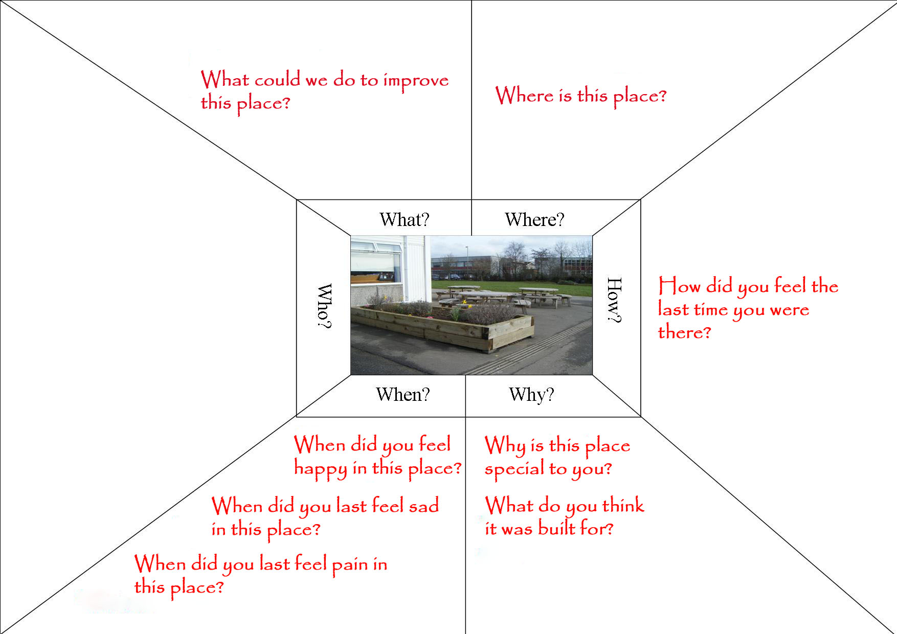
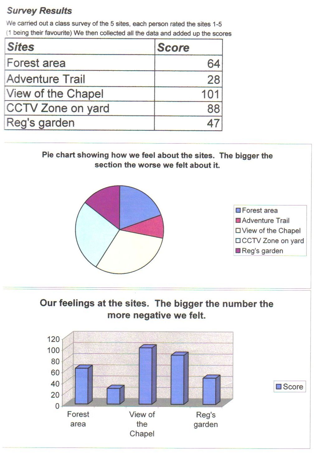
Using emotion charts / thinking webs to consider likes and dislikes in the school grounds
Using emotion charts / thinking webs to consider likes and dislikes in the school grounds
Using KWHL / ‘Thinking Hat’ grids to identify evidence needed
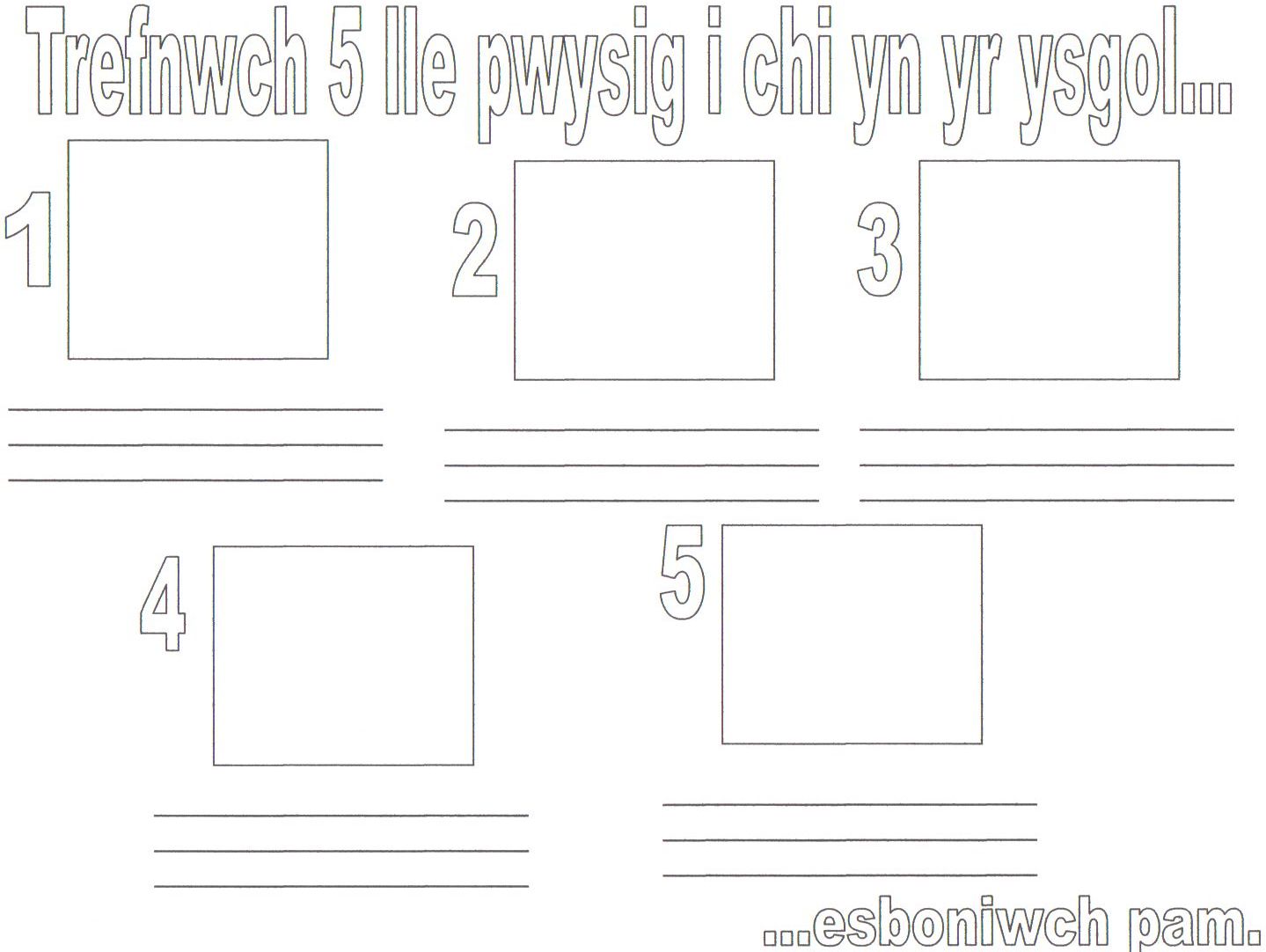
Using paper maps to suggest places for study
Conduct fieldwork to collect data / record on paper maps and survey sheets
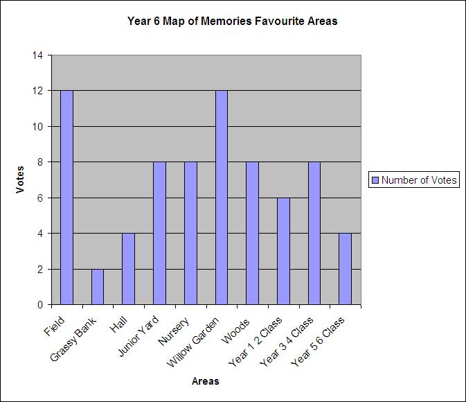
Making sense of our data – using GIS to communicate findings and display / explain patterns. Describe any spatial patterns of happy / sad memories
What conclusions can be made? Does everyone feel the same about areas in / around the school?
Complete a reflection triangle for pupils to reflect on how they learnt?
A Sense of Place - A unit of work for GIS in KS2
The Project – reflections by teachers involved
ADDITIONAL RESOURCES
PRIMARY GIS ACTIVITIES ON NGfL Cymru